Google Earth
Yesterday, I downloaded, installed and played with Google Earth, just like half of the internet population. I then found it a very nice toy. Exceptionally cool. The streaming technology is so beautifully implemented. But still, a toy. I couldn’t really see the real usefulness. As a technical person, I really have deep respect for the way the program works, but hey, unfortunally in the real world, you also need to have a business case in order to make things happen, and at that moment I didn’t see it.
But today, I played again, and I tried to locate the location of my grandparents house in a small town in the Czech Republic as precisely as possible. The town is so small, the don’t even have street names; the designation of their house is just
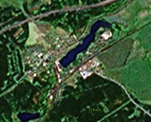
In this situation I really has to use the overlayed roads to pinpoint the location. The resoltion of the images isn’t good enough to make a visual identification.
The real power can be seen when you find a spot where high level quality images are available. For example, large parts of Prague.
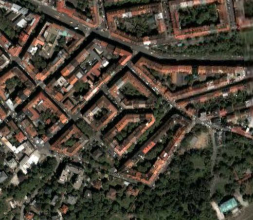
Here, you can clearly identify the separate houses (for the ones who recognize the surrounding: find the right house). When google will include more and more of these high resolution images (and obvously, they will), and more and more meta-information (at this moment, the US is already covered with large details), the power of the application will grow very fast.
Looking for a restaurant near a place you are visiting: use Google Earth.
Looking for a route between two places on earth: use Google Earth.
Looking for a way to give a physical location of something: send them a kmz file.
Looking for information about the place you are visiting during holiday: use Google Earth.
Hmm, maybe I should have bought some Google stock anyway.. :)